
AWWA DPOC56494
A Rural Water Master Plan is a Necessity
Conference Proceeding by American Water Works Association ,
Rabold, Rich; Smith, Darra; Bowns, Stu
Most Recent
Language:
-
-
Available Formats
- Availability
- Priced From ( in USD )
-
Available Formats
-
- Immediate download
- $24.00
- Add to Cart
-
- Printed Edition
- Ships in 1-2 business days
- $24.00
- Add to Cart
Customers Who Bought This Also Bought
-
AWWA DPOC56502
Priced From $24.00 -
AWWA DPOC56503
Priced From $24.00 -
AWWA DPOC56504
Priced From $24.00 -
AWWA DPOC56505
Priced From $24.00


About This Item
Full Description
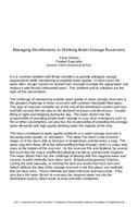
Trimble County, Kentucky is a small rural agricultural county located about 45 miles north of Louisville
along the Ohio River. Trimble County Water District No. 1 (TCWD1) serves the majority of the county.
TCWD1 was started in 1956, operated by contract until 1996 when it hired its first District Manager and
District Operator. By 2000, TCWD1 served about 1300 customers through 65 miles of system, supplying
about 250 gallons per minute from 265,000 gallons of water storage.
During the period 1996 - 1999, the District Manager and District Operator repeatedly found that there
was no in-house, written information to answer the fundamental management and operation questions. An engineering company learned of TCWD1 in 2000 through procurement for water line extension
design and subsequently identified the lack of a Water Master Plan and System Inventory Map tailored to
the small, rural water utility. The engineering firm was procured for a Master Plan through the
competitive process based on their experience with small, rural utilities and their innovations in water
technology.
In February of 2001, the Master Plan was completed that detailed the project planning-area, inventoried
and mapped the existing facilities, completed a system-wide hydraulic model, analyzed and projected
growth trends, assessed future capacity, and recommended cost saving improvements for operations and
planning.
The project planning-area work identified growth areas and population trends within the district that
needed to be planned for. Because of its central location between Louisville, Kentucky and Cincinnati,
Ohio, Trimble County is experiencing growth of 3% per year as a bedroom community to both cities. The mapping and
inventory of the existing facilities utilized the digital USGS topographic quadrangle map available free of
charge from the internet as a base. Posted on this map were the best known locations of all water lines down to 1-inch in diameter. Waterlines were color-coded for diameter identification and pipe material if
something other than PVC was noted. Also included on the digital map were the locations of all valves,
pressure reducers, hydrants, booster stations, water tanks, and wells. The digital mapping efforts served as a usable base for the development of a steady-state hydraulic model
using Haestad's WaterCAD model. System demands were allocated to the pipes based on the locations
and usage of customers determined from billing records. The hydraulic modeling analyses provided
information on:
where in the system pressures would be low or high;
where more water was available and where less;
where water would be younger (fresher) and where a flushing program was needed;
where line extensions would enhance or lessen the capacity of the system; and, where operational changes would produce immediate cost savings.
Operating the hydraulic model using the known triggers to turn the pumps on and off at each booster
station, readily identified weaknesses in the configuration of the system with respect to pump station
operation.
Finally, the model was used to determine the impact of adding more customers to simulate the 10 and 20
year growth projections.
